
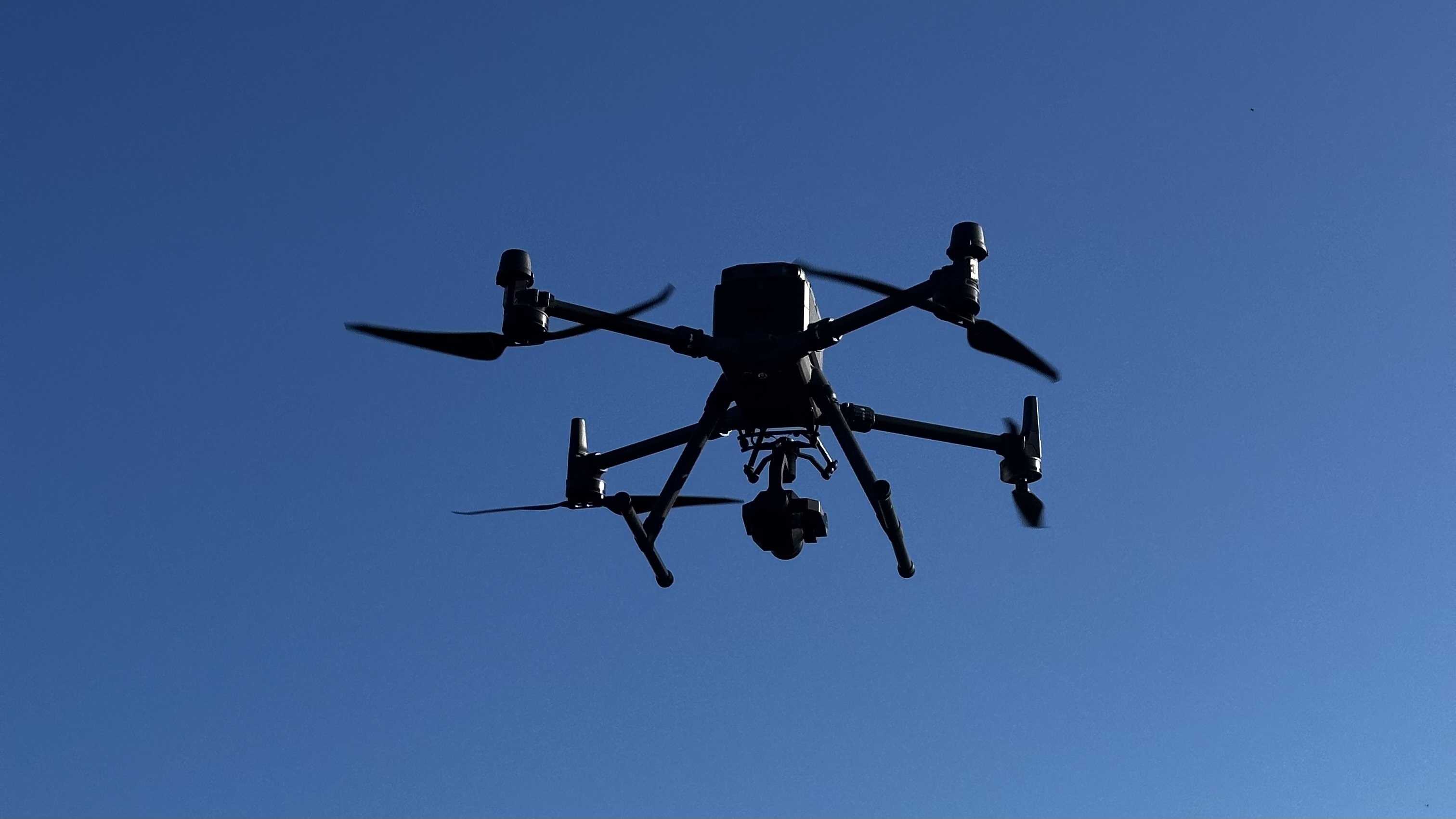
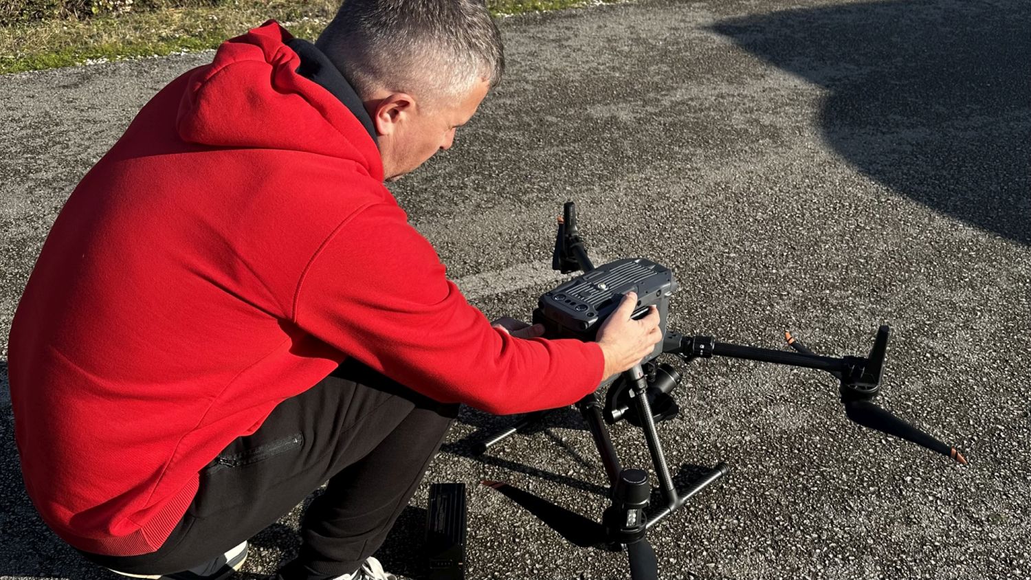
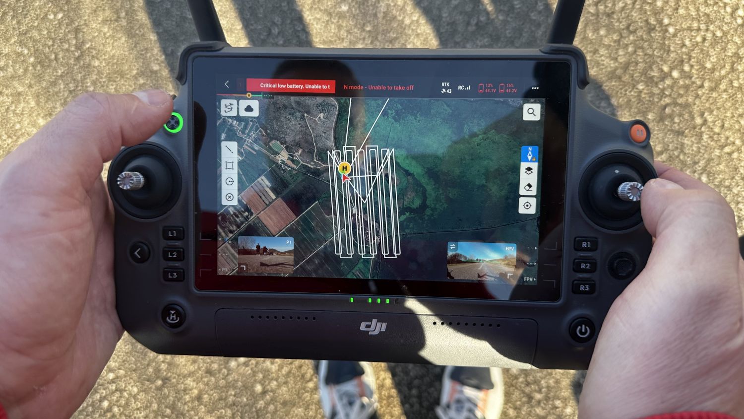
U okviru projekta KEEP‑GREEN, financiranog kroz inicijativu FUTURAL (Horizon Europe), Centar za investicije i razvoj poduzetništva (CIRP) započeo je sustavno terensko prikupljanje visokorezolucijskih prostornih i termalnih podataka pomoću bespilotnog zrakoplovnog sustava.
Cilj ove aktivnosti je izrada pouzdanih ulaznih slojeva za višekriterijsku analizu požarnog rizika u prostorno heterogenom i ekološki osjetljivom području istraživanja – Parku prirode Hutovo Blato. Današnji idealni vremenski uvjeti omogućili su nesmetano mapiranje dronom, čime je napravljen važan korak prema jačanju otpornosti i zaštite prirodnih resursa.
Ova inicijativa predstavlja značajan doprinos očuvanju bioraznolikosti i sigurnosti ekosustava Hutovog blata, te potvrđuje predanost CIRP‑a u provedbi inovativnih rješenja za održivo upravljanje prirodnim resursima.
KEEP‑GREEN: Drone mapping of Hutovo Blato begins
Within the framework of the KEEP‑GREEN project, financed through the FUTURAL (Horizon Europe) program, the Center for Research and Development (CIRP) has initiated systematic field collection of high‑resolution spatial and thermal data using an unmanned aerial system.
The aim of this activity is to create reliable input layers for multi‑criteria fire‑risk analysis in the spatially heterogeneous and ecologically sensitive area of Hutovo Blato Nature Park. Today’s ideal weather conditions enabled uninterrupted drone mapping, marking an important step toward strengthening resilience and safeguarding natural resources.
This initiative represents a significant contribution to the preservation of biodiversity and the safety of Hutovo Blato’s ecosystem, while reaffirming CIRP’s commitment to implementing innovative solutions for sustainable natural resource management.
This sub-project has received funding from the project FUTURAL (Grant Agreement number : 101083958) through its Open Call fundend by the Europen Union’s Horizon Europe research and innovation programme.
![]()
![]()